
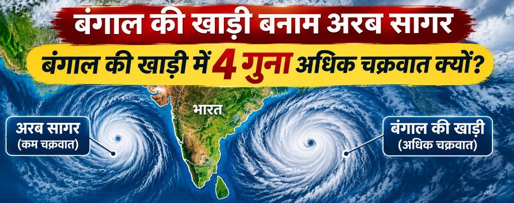
Why Bay of Bengal Has More Cyclones Than Arabian Sea: Geography & Disaster Management | MPPSC & UPSC Notes
Why does the Bay of Bengal witness 4 times more cyclones than the Arabian Sea? Detailed analysis of Sea Surface Temperature (>26.5°C), freshwater runoff from Ganga-Brahmaputra, funnel geography, 6-step cyclone genesis, IMD classification, WMO/ESCAP 169-name roster, and 8 practice MCQs for MPPSC & UPSC.

Why in News & Regional Meteorological Context
Bay of Bengal: Global Hotspot for Tropical Cyclones
- High Vulnerability: Flanking the eastern seaboard of India, the Bay of Bengal is recognized globally as one of the most storm-prone oceanic basins. Meteorological records confirm that nearly 80% of all tropical cyclones originating in the North Indian Ocean develop in the Bay of Bengal, compared to merely 20% in the Arabian Sea.
- 4:1 Cyclonic Ratio: The historical ratio of cyclonic disturbances between the Bay of Bengal and Arabian Sea stands at roughly 4:1. A combination of warm Sea Surface Temperatures (SST), heavy freshwater discharge from massive river systems, shallow bathymetry, and concave funnel geography drives this disparity.
- Syllabus Relevance: Essential for MPPSC Mains Geography Paper 1 Part B and Disaster Management Frameworks.
5 Primary Scientific Reasons Behind Frequent Bay of Bengal Cyclones
1. Elevated Sea Surface Temperatures (SST 28°C–30°C)
- Thermodynamic Engine: The recognized threshold for tropical cyclogenesis is 26.5°C. The Bay of Bengal consistently maintains temperatures between 28°C and 30°C, supplying colossal amounts of sensible and latent heat to sustain cyclonic vortexes.
2. Salinity Stratification via Freshwater Inflow
- Inhibition of Ocean Upwelling: Massive river discharges from the Ganga, Brahmaputra, Mahanadi, Godavari, Krishna, and Irrawaddy deposit enormous volumes of fresh, low-density water on the oceanic surface. This forms a buoyant, shallow 'barrier layer' that inhibits the upward mixing of cold deep-sea water, ensuring the sea surface remains superheated.
3. Funnel-Shaped Coastline Geometry
- Storm Surge Amplification: The northern curvature of the Bay, encompassing coastal West Bengal and Bangladesh, forms a natural geographic funnel. As cyclonic storms track northward, water is forced into an increasingly constricted concave basin, producing catastrophic tidal surges.
4. Weak Vertical Wind Shear
- Preserving the Vertical Eye-Wall: Low difference in wind speed and direction between lower and upper tropospheric levels enables towering convective cloud towers to stay vertically aligned without being sheared apart.
5. Re-intensification of Pacific Typhoon Remnants
- Trans-Basin Energy Transfer: Remnant atmospheric low-pressure systems originating in the South China Sea cross the Indochina landmass and enter the Bay of Bengal, where warm waters trigger rapid explosive cyclogenesis.
Bay of Bengal vs Arabian Sea: Meteorological Comparison
- Basin Contrast: Core physical and meteorological differences between both oceanic basins in the North Indian Ocean:
| Parameter | Bay of Bengal | Arabian Sea |
|---|---|---|
| Average SST | 28°C to 30°C (Warm Pool) | 26°C to 27°C (Cooler Basin) |
| Cyclone Frequency Ratio | 80% of total (4:1 Dominance) | 20% of total events |
| Freshwater River Inflow | Huge (Ganga, Brahmaputra, Irrawaddy) | Moderate (Narmada, Tapi, Indus) |
| Salinity Stratification | Lower salinity, buoyant top layer prevents cold upwelling | Higher salinity, strong vertical convective mixing |
| Coastal Bathymetry | Narrow concave funnel coast (High surge) | Open and deeper coastal configuration |
| Vertical Wind Shear | Very weak post-monsoon (Conducive) | Stronger winds disrupt vortex formation |
| Pacific Typhoons Influence | Frequent remnant inflow from South China Sea | Negligible direct Pacific influx |
6-Step Tropical Cyclogenesis Mechanism
- Step 1: Rapid Evaporation: Sea surface temperatures above 26.5°C trigger intensive moisture evaporation.
- Step 2: Low-Pressure Depletion: Warm moist air expands and ascends dynamically, carving out a deep atmospheric low-pressure core at sea level.
- Step 3: Atmospheric Inflow: Denser surrounding air rushes inwards toward the low-pressure pocket to balance the pressure gradient.
- Step 4: Release of Latent Heat: As warm air ascends, condensation forms cumulonimbus clouds, unlocking massive latent heat of condensation that acts as the thermal powerhouse.
- Step 5: Coriolis Spin Deflection: Earth's rotational Coriolis effect deflects converging air winds into a counter-clockwise spiral in the Northern Hemisphere.
- Step 6: Vortex Maturity & Eye Formation: The mature cyclone exhibits a calm central 'Eye' enveloped by the destructive, high-velocity 'Eye Wall'.
Tropical Cyclone Intensity Classification by IMD
- Official Scale: The India Meteorological Department (IMD) classifies cyclonic disturbances into 7 categories based on 3-minute maximum sustained wind speeds:
| Category | Wind Speed (Knots) | Wind Speed (km/h) | Typical Impact |
|---|---|---|---|
| Low Pressure Area | < 17 knots | < 31 km/h | Incipient stage disturbance |
| Depression (D) | 17 to 27 knots | 31 to 49 km/h | Localized rain squalls |
| Deep Depression (DD) | 28 to 33 knots | 50 to 61 km/h | Rough sea conditions |
| Cyclonic Storm (CS) | 34 to 47 knots | 62 to 88 km/h | Official naming occurs here |
| Severe Cyclonic Storm (SCS) | 48 to 63 knots | 89 to 117 km/h | Structural & foliage damage |
| Very Severe Cyclonic Storm (VSCS) | 64 to 89 knots | 118 to 166 km/h | Severe coastal storm surges |
| Extremely Severe CS (ESCS) | 90 to 119 knots | 167 to 221 km/h | Catastrophic damage profile |
| Super Cyclonic Storm (SuCS) | ≥ 120 knots | ≥ 222 km/h | Extreme devastation (e.g., 1999 Odisha) |
Cyclone Naming Mechanism: WMO/ESCAP Panel & 169-Name Roster
13 Member Nations, 169 Names & IMD's Mandate
- Institutional Mechanism: Cyclone nomenclature is managed under the mandate of the World Meteorological Organization (WMO) and the United Nations ESCAP panel.
- 13 Member Nations: The North Indian Ocean panel comprises 13 littoral nations: India, Bangladesh, Iran, Maldives, Myanmar, Oman, Pakistan, Qatar, Saudi Arabia, Sri Lanka, Thailand, UAE, and Yemen.
- 169-Name Roster: In April 2020, a new roster of 169 names was unveiled (13 names contributed by each of the 13 nations). Names are allocated sequentially following the alphabetical order of the contributing country.
- Naming Threshold: A storm is designated a name only when sustained wind speeds reach 34 knots (~62 km/h). New Delhi's IMD serves as the Regional Specialized Meteorological Centre (RSMC) responsible for tracking and naming.
Recent Cyclonic Events of October–November 2026
Recent Cyclones: Arnab and Murasu
- Cyclone Arnab: Formed in late October 2026 over the east-central Bay of Bengal, causing extensive squally rains across the coasts of Odisha and Andhra Pradesh.
- Cyclone Murasu: Developed in early November 2026 over the southwest Bay of Bengal heading towards Tamil Nadu and Puducherry. The name 'Murasu' was contributed by Maldives.
High-Yield Memory Points for MPPSC & UPSC Aspirants
- Critical SST Threshold for Cyclone Genesis: 26.5°C or higher.
- Major Freshwater River Systems: Ganga, Brahmaputra, Mahanadi, Godavari, Krishna, Irrawaddy.
- Primary Energy Source: Latent Heat of Condensation.
- Direction of Rotation in Northern Hemisphere: Counter-Clockwise (due to Coriolis deflection).
- Contributing Countries in North Indian Ocean: 13 littoral nations.
- Total Names on Approved Roster: 169 names (13 nations × 13 names each).
- Naming Wind Speed Threshold: 34 knots (~62 km/h).
- Designated Regional RSMC: India Meteorological Department (IMD, New Delhi).
Practice Questions
1How many littoral nations contribute names to the North Indian Ocean tropical cyclone roster?
2What is the recognized minimum Sea Surface Temperature (SST) threshold required for tropical cyclogenesis?
3What is the primary factor driving lower salinity and warmer surface water in the Bay of Bengal compared to the Arabian Sea?
4What is the minimum sustained wind speed required for an atmospheric system to be officially classified and named as a Cyclonic Storm?
5In which direction do tropical cyclones rotate in the Northern Hemisphere?
6What acts as the primary thermodynamic engine powering a tropical cyclone?
7Where is the designated Regional Specialized Meteorological Centre (RSMC) for cyclone forecasting and naming in the North Indian Ocean located?
8According to the IMD classification scale, what is the wind speed threshold for a Super Cyclonic Storm?
Frequently Asked Questions
साझा करें
Related Articles

MPPSC & UPSC: 2026 Asian Games Indian Medal Winners List (Full 1 to 48 Medallists Table) | 10m Air Rifle & Complete Winners
Complete official list of all 48 Indian medal winners (1 to 48) at the 2026 Asian Games in Aichi-Nagoya, Japan. Features Elavenil Valarivan, Rudrankksh Patil, Parth Mane, Himanshu Dhillon, Neeru Dhanda, Mirabai Chanu, Team India Cricket/Kabaddi, and all medalled events with MPPSC notes.

72nd National Film Awards 2026 Winners List Hindi: 2024 Winners Table, Filmfare Awards Comparison & MPPSC / UPSC Exam Notes
Complete 72nd National Film Awards 2026 Winners List in Hindi & English for 2024 certified films. 'Article 370' wins Best Feature Film, Kartik Aaryan & Mammootty win Best Actor, Yami Gautam wins Best Actress. Includes full winners table, Filmfare Awards comparison, and 8 practice MCQs for MPPSC & UPSC.

IPS Sanjukta Parashar Appointed First Female IG of CRPF CoBRA: Career Profile, Security Forces & Exam Notes
IPS officer Dr. Sanjukta Parashar (2006 batch, Assam-Meghalaya cadre) has been appointed as the first woman Inspector General (IG) of CRPF CoBRA (Commando Battalion for Resolute Action). Read her career profile, CoBRA operational role, and key exam notes.
Join Aakar IAS Community
Get daily Current Affairs PDFs directly on your WhatsApp, or join our official Telegram & WhatsApp channels.