
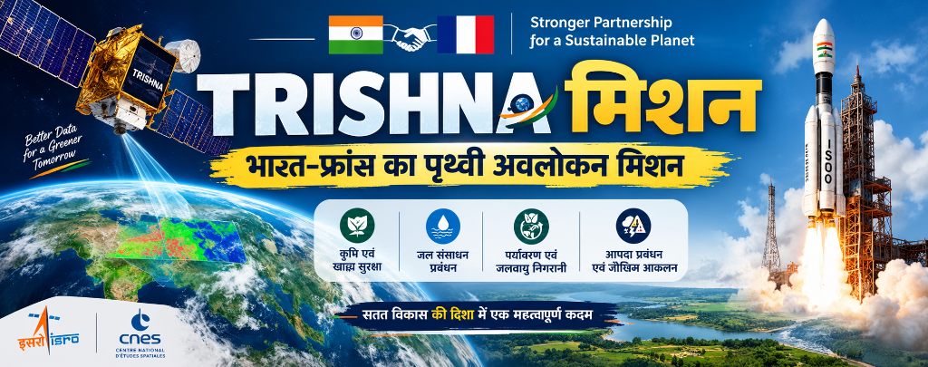
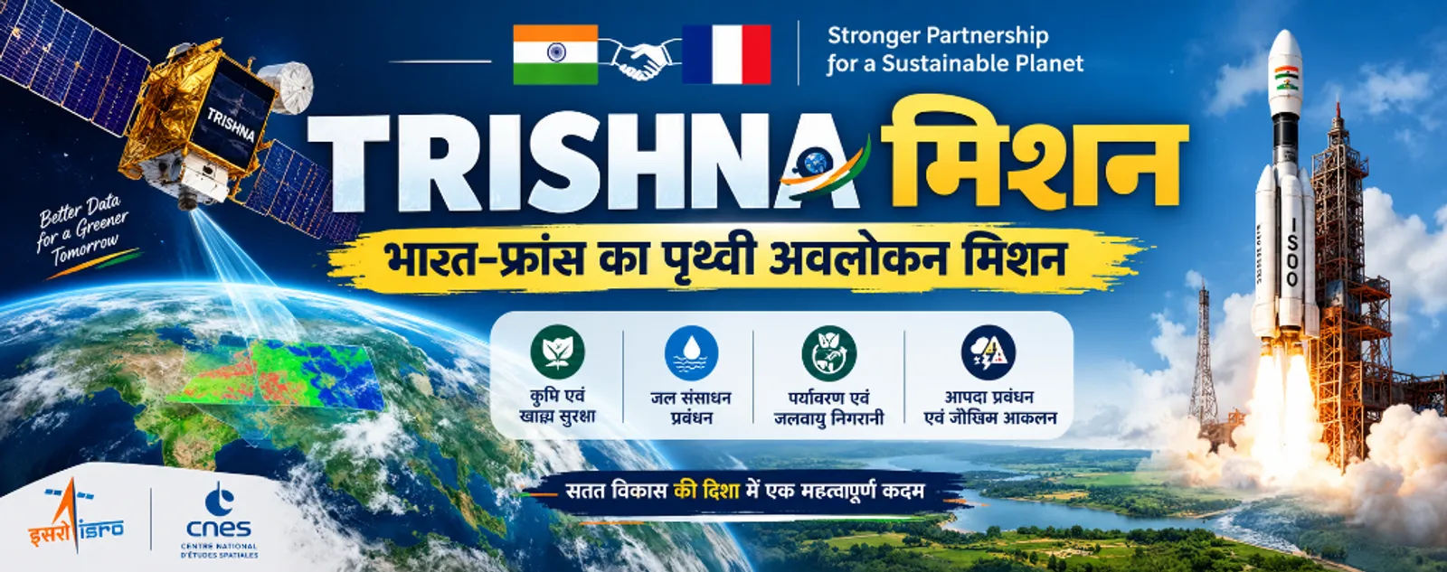
TRISHNA Mission: ISRO & CNES Joint Earth Observation Satellite, TIR & VNIR Payloads, Water Stress, GEOGLAM & Global Water Watch | MPPSC & UPSC
Comprehensive analytical study of TRISHNA Mission by ISRO & CNES France. Covers 761 km Sun-Synchronous Orbit, TIR (CNES) & VNIR-SWIR (ISRO) payloads, 57m spatial resolution, water stress monitoring, GEOGLAM (G20 initiative), Global Water Watch, 10 FAQs, and 8 practice MCQs for MPPSC & UPSC exams.

Key Highlights
TRISHNA (Thermal InfraRed Imaging Satellite for High-resolution Natural Resource Assessment) is a landmark joint Earth Observation (EO) satellite mission developed by India's space agency ISRO (Indian Space Research Organisation) and France's national space agency CNES (Centre National d’Études Spatiales). The primary objective of TRISHNA is to provide high-resolution thermal mapping of Earth's surface temperature, terrestrial water stress, crop evapotranspiration, inland and coastal water quality, urban heat islands, and climate change dynamics. From the perspective of competitive examinations (MPPSC Mains Paper 3 - Science, Tech & Environment and UPSC GS Paper 3 - Science & Technology, Environment & Agriculture), understanding TRISHNA's technical parameters, scientific payloads, GEOGLAM framework, and Global Water Watch integration is crucial. For updated coverage, follow our MPPSC Current Affairs and General Awareness portals.
1. TRISHNA Mission: Key Technical Parameters
- Full Form: TRISHNA (Thermal InfraRed Imaging Satellite for High-resolution Natural Resource Assessment).
- Partner Agencies: ISRO (India) and CNES (France).
- ISRO Contribution: VNIR-SWIR payload development, satellite bus design, and launch operations.
- CNES Contribution: TIR (Thermal Infra-Red) payload development and thermal data processing.
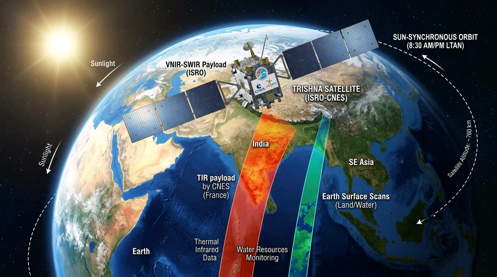
- Target Orbit: Sun-Synchronous Orbit (SSO) at an altitude of 761 km.
- Design Lifespan: 5 years.
- Spatial Resolution (Land & Coastal): 57 meters (High-resolution thermal mapping).
- Spatial Resolution (Ocean & Polar): 1 kilometer.
2. Scientific Payloads of TRISHNA Satellite
- 1. TIR Payload (Thermal Infra-Red): Developed by France's CNES, this 4-channel Long-Wave Infrared (LWIR) sensor accurately measures Land Surface Temperature (LST) and land emissivity.
- 2. VNIR-SWIR Payload (Visible Near Infrared - Shortwave Infrared): Developed by India's ISRO, featuring 7 spectral bands for vegetation health, surface albedo, soil moisture, and atmospheric corrections.
3. Core Scientific Objectives of TRISHNA
- Terrestrial Water Stress Assessment: Precise evaluation of evapotranspiration and soil moisture deficit in agricultural fields.
- High-Resolution Temperature Mapping: Mapping Earth's land surface temperature at 57-meter resolution.
- Irrigation & Crop Water Efficiency: Supporting farmers and policymakers in efficient irrigation water management.
- Inland & Coastal Water Quality: Monitoring water temperature anomalies, turbidity, and dynamics in rivers, lakes, and coasts.
- Urban Heat Island (UHI) Studies: Assessing micro-climatic thermal variations and heatwaves caused by rapid urbanization.
- Geothermal & Volcanic Monitoring: Detecting thermal anomalies from active volcanoes and geothermal energy sources.
- Glacier & Cryosphere Safety: Tracking glacier retreat, snow melt dynamics, and permafrost thaw in Himalayan and polar regions.
- Atmospheric Profiling: Providing essential data on aerosol optical depth, water vapor, and cloud cover.
4. Strategic & Practical Importance of TRISHNA
- Agriculture & Food Security: Enhances crop water productivity, enables early drought warning systems, and promotes precision farming.
- Climate Change Monitoring: Provides long-term scientific datasets on evapotranspiration, global warming impacts, and land degradation.
- Water Resource Management: Helps monitor reservoir storage capacity, identify submarine groundwater discharge, and manage water-stressed zones.
- Cryosphere & Hydrological Safety: Critical inputs for Glacial Lake Outburst Flood (GLOF) risk assessment and hydroelectric power management. For structured notes, explore our MPPSC Notes.
5. Understanding GEOGLAM & Global Water Watch
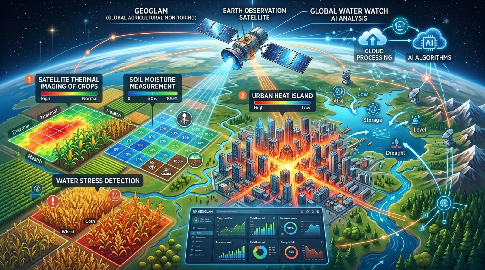
- GEOGLAM (Group on Earth Observations Global Agricultural Monitoring): Launched by G-20 Agriculture Ministers in June 2011 as part of the G-20 Action Plan on Food Price Volatility. It aims to enhance Earth Observation data usage for global food security, crop yield forecasting, and market transparency.
- Global Water Watch: An advanced global water resources data platform utilizing Artificial Intelligence (AI) and Earth Observation (EO) technologies. It provides real-time information on global reservoir water volumes, river levels, and hydrological discharge rates. To strengthen your exam readiness, check out our Online Courses and Publications.
6. Quick Revision Points for MPPSC & UPSC Exams
- TRISHNA → Joint Earth Observation Mission of ISRO (India) and CNES (France)
- TIR Payload → 4-channel Long-Wave Infrared sensor built by CNES
- VNIR-SWIR Payload → 7 spectral band sensor built by ISRO
- Orbit & Altitude → 761 km Sun-Synchronous Orbit (SSO)
- Design Lifespan → 5 Years
- Spatial Resolution → 57 m for Land/Coast, 1 km for Ocean/Polar
- Primary Applications → Water stress, LST, Urban Heat Island, glacier monitoring
- GEOGLAM → G-20 Agriculture Ministers initiative launched in June 2011
- Global Water Watch → AI & EO powered global water body monitoring platform
Practice Questions
1TRISHNA Mission is a joint initiative of which two space agencies?
2The TIR (Thermal Infra-Red) payload onboard TRISHNA satellite has been developed by which agency?
3In which orbit and altitude is TRISHNA satellite proposed to be launched?
4What is the spatial resolution of TRISHNA mission for thermal mapping of land and coastal areas?
5The global agricultural monitoring initiative 'GEOGLAM' was launched at the initiative of Agriculture Ministers of which group?
6Consider the following statements regarding TRISHNA Mission: 1. The VNIR-SWIR payload with 7 spectral bands has been developed by ISRO. 2. The planned operational lifespan of this mission is 10 years. Which of the above statements is/are correct?
7Which global data platform monitors reservoir volumes and river flows using AI and satellite data?
8TRISHNA Mission will aid in the study of which of the following thermal and environmental phenomena?
Frequently Asked Questions
साझा करें
Related Articles

International Day of Democracy 2026: 15th September, Civic Participation, Accountable Governance, IPU, UDHR & UNDEF | MPPSC & UPSC
Complete analytical coverage of International Day of Democracy observed on 15th September 2026. Covers 2007 UNGA resolution, 1997 IPU Universal Declaration on Democracy, ICNRD process, 2026 focus on civic participation, UDHR Article 19, UN Democracy Fund (UNDEF), parliamentary roles, 10 FAQs, and 8 practice MCQs for MPPSC & UPSC exams.

18th BRICS Summit 2026 (New Delhi): India's Chairship, Agenda, Strategic Interests, 11 Member Nations, NDB & 25-Year Journey | MPPSC & UPSC Notes
Complete guide to the 18th BRICS Summit held under India's presidency on 12-13 September 2026 at Bharat Mandapam, New Delhi. Covers full summit agenda, India's 11 strategic interests, 25-year milestone (2001-2026), BRICS expansion to 11 members, Thirukkural gift, NDB & 8 MCQs for MPPSC & UPSC.

Ramon Magsaysay Award 2026: Full Winners List, Asia's Premier Honor & Key Exam Facts (MPPSC & UPSC)
The 68th Ramon Magsaysay Award 2026 honours three Asian leaders: Tommy Koh (Singapore), Runa Khan (Bangladesh), and Bo Kyi (Myanmar). Explore the history of Asia's Nobel Prize, Indian laureates, and 8 practice MCQs for MPPSC & UPSC.
Join Aakar IAS Community
Get daily Current Affairs PDFs directly on your WhatsApp, or join our official Telegram & WhatsApp channels.